
Maps, current projects, and data along the Washington coast.
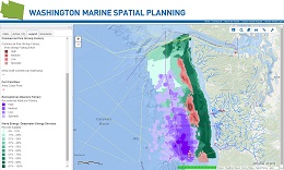
Mapping Application
Explore data layers through this interactive mapping tool. This dynamic interacting mapping tool includes data layers showing human uses, marine life, habitat, physical oceanography of Washington’s coastal waters, and more! This tool is designed to support you in participating in the Marine Spatial Planning process.